
SESAR partners have developed a new method to speed up the mapping of weather radar observations in 3D in terminal manoeuvring areas (TMA) or the airspace close to airports. The new method is the result of a SESAR collaboration led by EUMETNET EIG, and involving Météo France and the UK’s Met Office for the MET work package 11.02.
A large number of weather radars are used operationally by national meteorological services across Europe to capture the 3D structure of clouds and precipitation in the atmosphere in real time, at spatial scales down to 0.5 km and with update frequencies of the order of 5 minutes. EUMETNET EIG operates the European composite weather radar (OPERA) composed of national information from more than 200 weather radar facilities, which is currently used by EUROCONTROL’s Network Manager. However the generation of high spatial and temporal resolution 3D weather radar products is computationally expensive and the production in real-time is limited by the time required to retrieve and map the observations produced by the radars onto 3D compositing grids.
The algorithm developed for SESAR overcomes the current limitations by employing a novel technique to speed up the ‘near neighbour’ search, allowing mapping algorithms to run faster and to produce high-resolution composites in real-time over a large geographical area. This novel technique uses a Binary Space Partition tree (specifically, a k-dimensional tree) a concept commonly employed in computer graphics[1].
High spatial and temporal resolution 3D radar products benefit the aviation community especially in the extended TMA where a detailed knowledge of the 3D structure of a convective storm can help air traffic control vector aircraft to avoid the worst convection and turbulence associated with a storm. From a network perspective, hot spots will develop on convective days as the storms develop and move, disrupting the en-route or the descent trajectories flown by aircraft. The availability of up-to-date detailed observations from 3D radar products over larger domains assists in tactical decision making and can be used to advise pilots of the most suitable route through, around or over disrupted areas.
The new 3D weather radar mapping method has been used in SESAR large scale demonstrations like TOPLINK, and further development work is foreseen to enable its deployment in the aviation community.
[1] A more detailed report of this work has been published in the Journal of Atmospheric and Oceanic Technology: Scovell, R and H. Al-Sakka, 2016: A Point Cloud Method for Retrieval of High-Resolution 3D Gridded Reflectivity from Weather Radar Networks for Air Traffic Management. Journal of Atmospheric and Oceanic Technology 33 461-479
Visit: http://journals.ametsoc.org/doi/abs/10.1175/JTECH-D-15-0051.1?af=R

This is a 1024 x 1024 x 48 grid with 500m horizontal resolution and 250m vertical resolution. The grid extent is 512km x 512km x 12km and is centred on London Heathrow Airport. The central panel is a cross-section at 2km constant altitude, and the side and top panels indicate the vertical extent of the precipitation.
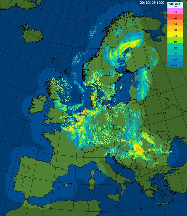
Image of the OPERA Radar composite over Europe. Over 200 radars within Europe are harmonised into one composite.