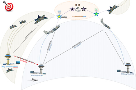
One of the main obstacles of reaching Single European Sky’s objectives is management of flight trajectories. Inaccuracies are difficult to spot and information given to stakeholders about the trajectory is limited, arriving late, and full of inconsistencies and wrong assumptions. Military Flights are currently not integrated in the ATM-system, so demanding special treatment.
Additionally, there is a lack of complete, updated, unique and coherent aeronautical and meteorological information at European level, which again limits the accuracy of the predicted trajectory and so difficult detecting incoming issues and designing optimum solutions.
This project addresses solutions for the above limitations. Harmonized and global trajectory information sharing, including improved negotiation mechanisms, enabled significant operational benefits on flight management. The aim is to enable a unique and integrated view of all flights trajectories (including military ones) among the stakeholders. This is improved thanks to new tools and capabilities ensuring all stakeholders are managing a single, updated and complete view of the forecasted meteorology and airspace configuration.
Both solutions above increased safety and efficiency - a very important step towards ensuring that anyone can fly safer, cheaper and quicker in Europe in 10 years.
As so many stakeholders were involved, this issue cannot be solved at national level. All stakeholders (mainly air navigation service providers, as well as air and ground industry partners) need to be involved as all needed to perform changes to ensure successful implementation. The SESAR 2020 Programme is the only place where this can happen.
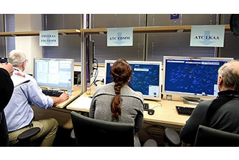
In this project we have ensured participation of the major ATM stakeholders which ensures having the knowledge and expertise to come up with the concepts, prototypes and platforms to provide sustainable results usable throughout Europe.
Industrial research PROJECT
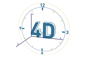
4D trajectory management
In short
|
|
|
|---|---|
|
PROJECT ID
|
PJ18 4DTM |
|
PROJECT TYPE
|
Industrial research |
|
FLAGSHIP
|
Not applicable |
|
STATUS
|
Completed |
|
SESAR PROGRAMME
|
SESAR 2020 |
|
PROJECT DURATION
|
2016-11-01 > 2020-11-30 |
|
TOTAL COST
|
€ 49.248.700,47 |
|
EU CONTR.
|
€ 22.193.941,11 |
|
GRANT ID
|
734161 |
|
PARTICIPANTS
|
Indra Sistemas Sa, Airbus, Leonardo, Deutsches Zentrum für Luft- und Raumfahrt, Rizeni Letoveho Provozu Ceske Republiky Statni Podnik, Hrvatska Kontrola Zracne Plovidbe, Dassault Aviation, DFS Deutsche Flugsicherung , Direction Des Services De La Navigation Aerienne (DSNA), Enaire, Enav, Eurocontrol, Frequentis, Honeywell Aerospace, NATS, Skyguide, Thales Las France , Thales Avs France , Letove prevadzkove, Polska Agencja Zeglugi Powietrznej, Naviair, Luftfartsverket, Austro Control , Stichting Koninklijk Nederlands Lucht - En Ruimtevaartcentrum, Oro Navigacija, Udaras Eitliochta Na Heireann - The Irish Aviation Authority (IAA), HungaroControl, Eviden |